system.file("ex/elev.tif", package="terra")Tasks
Task 1
The following command returns the path to a tif file on your hard drive:
Use this path to import the tif file using rast(), store it as r. It contains the elevation of Luxembourg.
Sample Solution
library("terra")
r <- system.file("ex/elev.tif", package="terra") |>
   rast()
Task 2
Calculate the (global) mean, maximum and minimum elevation values.
Sample Solution
global(r, c("mean","max","min"), na.rm = TRUE) mean max min
elevation 348.3366 547 141Task 3
Calculate slope and aspect (see terrain functions)
Sample Solution
r_slope <- terrain(r, "slope")
r_aspect <- terrain(r, "aspect")
Task 4
Determine suitable locations of solar panels using the following conditions:
- Elevation: above 300 MASL
- Slope: Between 1 and 3°
- Aspect: Southfacing (between 135 and 235°)
Sample Solution
good_elev <- r > 300
good_slope <- r_slope > 1 & r_slope <= 3
good_aspect <- r_aspect > 135 & r_aspect <= 235

good <- good_elev & good_slope & good_aspect

plot(good, main = "Solar panel suitability")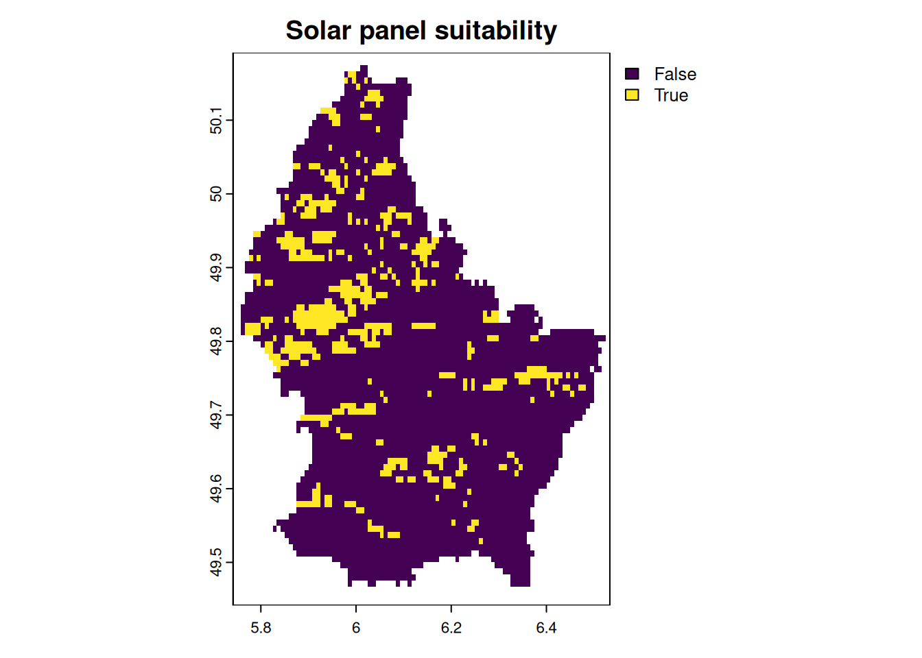
Task 5
Import the municipalities of Luxembourg (see below) and calculate the minimum, maximum and mean elevation values per municipality.
Sample Solution
lux <- system.file("ex/lux.shp", package="terra") |>
  vect()

zones <- rasterize(lux, r, "NAME_2")
Task 6
Smooth the elevation values using different focal windows
Task 7
Import the multispectral Landsat 7 as a raster using the following path
Sample Solution
system.file("tif/L7_ETMs.tif",package = "stars")Sample Solution
l7 <- system.file("tif/L7_ETMs.tif",package = "stars") |>
   rast()
Task 8
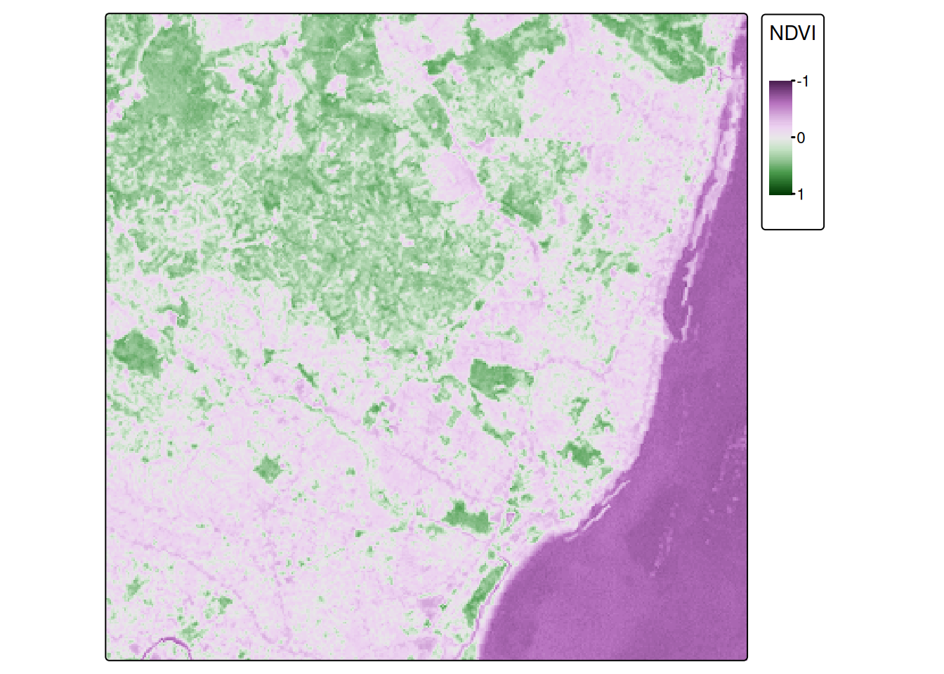
Calculate the NDVI using the following formula:
\[\text{NDVI} = \frac{\text{NIR}-\text{red}}{\text{NIR}+\text{red}}\]
Sample Solution
names(l7) <- c("B", "G", "R", "NIR", "SWIR", "MIR")


NDVI <- (l7[["NIR"]]-l7[["R"]])/(l7[["NIR"]]+l7[["R"]])

library(tmap)


tm_shape(NDVI) + tm_raster(style = "cont", title = "NDVI", midpoint = 0, breaks = c(-1,0,1)) +
  tm_layout(legend.outside = TRUE)